Category Archives: Utah National and State Parks

Visits to Zion National Park, Bryce, Kodachrome, Arches, Moab, Dead Horse, Goblin, Escalante, Monument Valley

Monument Valley, Utah: John Wayne Country

John Wayne country here we come.  I had no idea John Wayne would be such a hero in this canyon country section of Utah but everywhere you go in Monument Valley, you run into John Wayne.  Whether it is a movie poster, a life-size cut out, a DVD, or photos, you are going to become intimately acquainted with John Wayne here.  Monument Valley is a Navajo Tribal Park (30,000 acres) at 5,500 feet elevation. The Navajo Indians that still live in the park might live in hogans, the traditional domed, hexagon-shaped structure with no running water or electricity.  A few of them prepare and spin wool the old-fashioned way, using dyes from native plants.

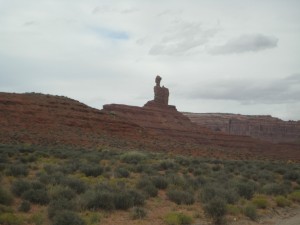
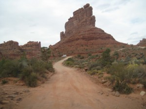
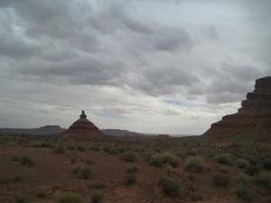
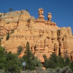
Interesting Rock forms

Interesting Rock forms

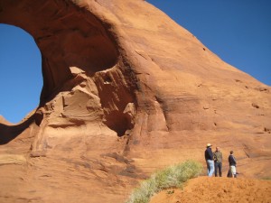
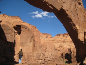
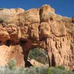
Note people to the right of natural bridge

Note people to the right of natural bridge

We made the fortunate decision to stay in Gouldings Campground.  Harry Goulding and his wife, “Mike”, came to Monument Valley in 1924 and established a Trading Post.  The Gouldings apparently were renowned for their integrity, honesty, and genuine concern for Indian welfare.  Today Gouldings has a Gift Shop, museum, dining room, theater, market, gas station, Lodge, campground and Gouldings Tours.  With that many services run by one company, you might imagine a lackluster performance.  But we found the opposite to be true.  The campground was well run with a laundromat and a computer and a shower room and indoor pool.  The museum was filled with movie memorabilia and replicas of the Gouldings original living quarters, a television that ran John Wayne movies, and lots of history.  The meal in the dining room was excellent, fast service, beautiful views, and Navajo Fry Bread.  The Navajo personality was enthralling to me, so laid back, gentle, and “take-life-as-it-comes,” family/community-oriented.  I could never imagine being that unwound.

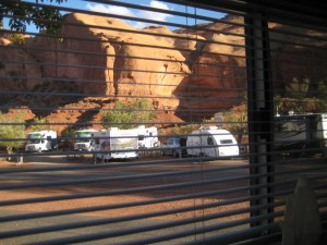
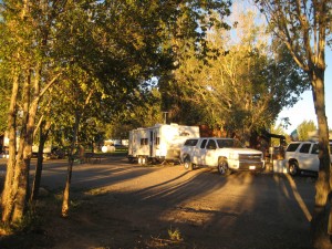
Gouldings Campground from our trailer

Gouldings Campground from our trailer

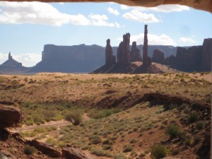
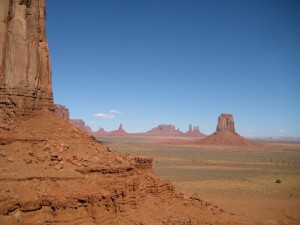
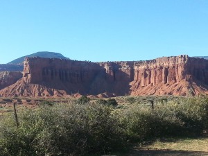
Grand View of Monument Valley

Grand View of Monument Valley

We took a Gouldings Tour through Monument Valley and for 3 1/2 hours our Navajo guide kept me glued to the seat listening to her stories about living as a Navajo.  We saw petroglyphs, natural arches, Anasazi ruins, and movie locations in addition to the famous monuments.

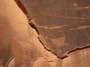
Petroglyph of ancient people

Petroglyph of ancient people

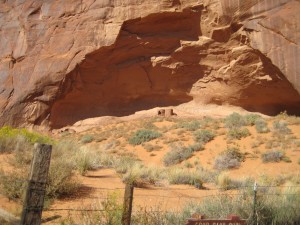
Site of ancient puebloans

Site of ancient puebloans


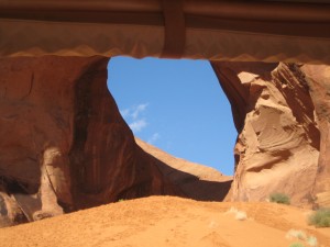
A natural bridge in Monument Valley

A natural bridge in Monument Valley

The tour was an open-air truck like transport and was freezing cold when we started at 8:30 a.m.  The Navajos obviously don’t believe in road improvement so there is much jarring and jolting as the truck drives down gullies and deeply rutted dirt roads.  We all scrambled out to stretch our legs when the truck stopped, a welcome relief from the bouncing ride.  What can be more beautiful than seeing horses run wild across the Mesa, sun lighting the canyon, blue sky peeking through round sandstone rock openings, rolling mounds of tan sand to climb, and the freshness of an autumn morning?

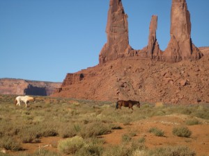
Wild horses in Monument Valley

Wild horses in Monument Valley

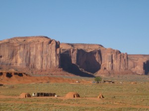
Navajo Kivas, Monument Valley

Navajo Kivas, Monument Valley

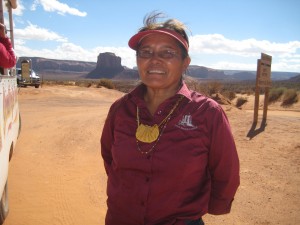
Carol, our Navajo guide, told us about learning to herd sheep as a young girl and being left on the top of a Mesa with the sheep for a week at a time.  She learned how to catch and butcher small animals for food.  She was 10 hears old.  I loved her gentle, calm manner of speaking, so unpretentious and down-to-earth.

Carol, Our Navajo Guide

Carol, Our Navajo Guide

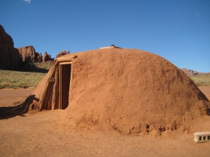
The hogans were amazing structures with logs laid in a hexagon-shaped manner on support logs.  There are only a few Navajos that know how to build the hogan and they are consulted for the building.  Once built, the outside is covered with sandstone mud until it is smooth.  Inside the hogan, it felt quite comfortable and cozy with more space that imagined.

Navajo Kiva

Navajo Kiva

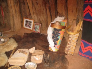
Navajo Cradleboard to the right

Navajo Cradleboard to the right

We watched a Navajo lady make yarn from sheep wool, card the wool, spin the yarn, and weave the rug.  The babies were strapped in a cradleboard for the first few years of life.  To give birth, the mothers hands were tied to the wood logs of the hogan roof and straps around her belly were pulled down by the ladies assisting the birth.  Of course my mouth was hanging open in disbelief all the while thinking, trying to imagine what a Navajo birth was like.  And then to think of the baby being strapped on a board for the first couple years of life.

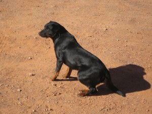
Local Dog Monument Valley

Local Dog Monument Valley

Our driver to and from the Earth Spirit Theater was another gentle, calm, pleasant Navajo youth.  It seemed there was nothing he would not do to make us happy.  He was not pretentious, he was easy going and pulled you in with his warmth and genuinely helpful nature.  We took the shuttle from our campground to the Earth Spirit Theater for the 8 o’clock John Wayne movie which happened to be “Stagecoach” the Saturday night we were there.  How thrilling to see this movie in the setting where it was filmed.  Stagecoach was the first film made in Monument Valley in 1938 and propelled John Wayne as a star.

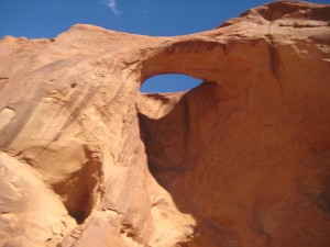
Natual bridge, Monument Valley

Natual bridge, Monument Valley

You've seen this landscape in a John Wayne movie

You’ve seen this landscape in a John Wayne movie

Next to the Theater was the room used as a set for the movie, “She Wore a Yellow Ribbon.” Our driver shuttled us back to camp after the movie, keeping us smiling with his friendly conversation.  Sunday night he picked us up so we could view the Earth Spirit film and a documentary about Monument Valley.  He ran the documentary once for us and again at the regular time.  He also ran the first fifteen minutes of “The Searchers” for us between scheduled movies.  Then he shuttled us back to camp; but first when I expressed how grand it would be to see the whole movie “The Searchers” while in Monument Valley, he drove us to the Lodge where he said we could rent the DVD, which we did.  There was a half moon shining on the canyon wall as we arrived back at camp and his helpfulness left such a warm feeling, it all felt magical.  We popped popcorn and watched The Searchers before retiring by the light of the moon our last night in Monument Valley.
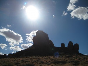
Admiring the massive rock

Admiring the massive rock

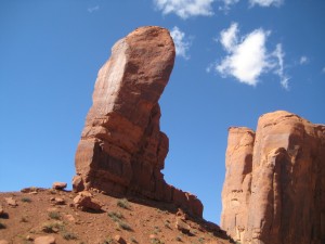
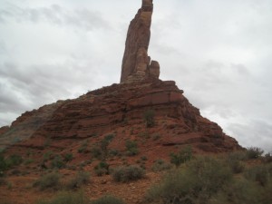
"Thumb", Monument Valley

“Thumb”, Monument Valley

Serendipity, Goblin Valley State Park, Deadhorse State Park, Natural Bridges National Park and Blanding

PhilCarla

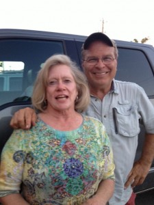
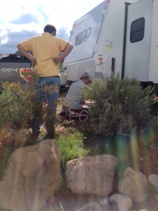
Phil and Karla. At the Bryce Cannonville KOA, a rig pulled in to the spot next to ours on a stormy, cloudy day. I said hello to the new RV neighbors as I ran to the laundry room to do wash. Before long Phil (as we later learned) called out to our trailer inviting Bill to join the men in solving a mechanical problem. Turns out his hitch was attached to the ball and was stuck so that Phil was unable to unhook. It took three men about two hours to solve the problem and by that time they bonded as fellow members of the military.
Bill ponders Phil's trailer problem Bill ponders Phil’s trailer problemThree heads are better than one Three heads are better than one

The men disassembled the hitch, cut the electrical, and reassembled. Later Phil invited us to join he and his wife for dinner in town. A great idea, I thought. Phil was gregarious and Karla was quieter and supportive. We chatted through dinner like old friends. Afterwards we got a tour of Phil and Karla’s trailer. We finally retired for the night, only to have Phil knocking on the door to loan us a DVD, Trimuph of the Nerds because we mentioned we were listening to the Steve Jobs story. It was hard to say goodbye the next day. I really enjoyed our time with Phil and Carla.

Turns out we didn’t have to say goodbye. Our next stop was Kodachrome Basin State Park and Phil and Carla drove over in the afternoon and we sat in our trailer and chatted most of the afternoon. There were from the Austin, Texas, area and had been married one year longer than us. We exchanged emails and promised if we were ever in Austin or if they were ever in Palm Desert, we would look each other up.

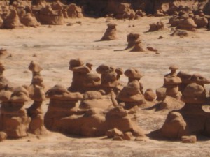
Goblin Valley is a unique, small State Park off the beaten path. Campsite, Goblin Valley State Park Campsite, Goblin Valley State Park

You drive 12 miles off the highway and you are in the middle of nowhere. There is so little out by Goblin Valley you will find wild, open space, goblins, a small visitors center and a 25-site campground.
Goblin Valley Goblin Valley

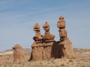
There are several trails and Goblin Valley with its stone gnomes and uniquely shaped goblins.
Goblin Valley Closeup Goblin Valley Closeup

You should be able to hear a pin drop in this isolated camp; however, because of the lack of background noise, sound carries so if there are people laughing and talking in one part of the camp, it sounds like there is an entire regiment of people merrymaking. You should also be able to do some serious stargazing, which you can do providing the campers keep their lights to a minimum.
Camp at Goblin Valley State Park Camp at Goblin Valley State Park

There are very few large trees or bushes which contributes to the traveling of sound and light between camps. The Valley of Goblins is so unique and visitors can wander for hours among the strange shapes or have a picnic overlooking the valley.
Goblins Goblins

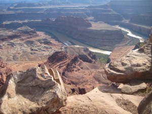
Dead Horse Point State Park is another state park that became very popular in light of the Federal Government shutdown. We were fortunate to have a one-night reservation. Because the Grand Canyon was also closed, we were grateful to have a chance to see breathtaking canyons.

Dead Horse Canyon Dead Horse Canyon

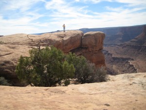
The campground has only 21 sites, but the Park has an extensive visitor center and plenty of hikes. We chose the Big Horn Overlook which we could hike from our camp. The views on this hike were spectacular. Later a ranger told us that the views from this trail are the same ones that Canyonlands visitors see. At the end of the trail, a crevice with dropoffs on each side blocked the last overlook. It was a pretty easy jump, except if you looked down because then your heart would get stuck in your throat envisioning how far you could fall. Because I am not a Big Horn sheep, I declined, but Bill jumped. On the rocks, Bill chatted a group from Lake Tahoe.
West Rim Trail, Dead Horse State Park West Rim Trail, Dead Horse State Park

Bill on rock that drops off down to canyon

Bill on rock that drops off down to canyon

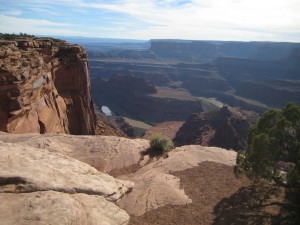
Views of the canyon

Views of the canyon

Little chipmunk Little chipmunk

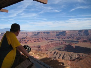
From our camp, we could bike to Dead Horse Point and this was another spectacular view of canyons. We were grateful and decided we didn’t have to feel deprived about not seeing the Grand Canyon. There are also nine miles of mountain biking trails, which we did not get to explore. Instead in the morning we rode our bikes back out to Dead Horse Point for another look at the canyons before hitching up.
Dead Horse Point overlook Dead Horse Point overlook
Bike rider on the trail Bike rider on the trail

DeadhorsePoint4

Blanding is another small town, population 3,600, along Hwy. 191. Many of the Mormon pioneer families that originally settled in Bluff ended up moving to Blanding, which was slightly more hospitable. The town sits at an elevation of 6000 feet. The Blanding Visitors Center and pioneer museum hold more fascinating history about the Hole-in-the-Rock settlers.

Edge of the Cedars State Park and Museum make for an interesting afternoon learning about the ancient Puebloan culture.

Edge of Cedars Museum, Blanding

Edge of Cedars Museum, Blanding

Connie descending 1000 year-old-kiva Connie descending 1000 year-old-kiva
Ladder to enter and exit kiva Ladder to enter and exit kiva

My favorite was getting to climb down a ladder into a Kiva, the dwelling structure built underground where the Indians lived. It was dark, with a dirt floor, no windows, and since it had recently rained, puddles to step around. The Kiva made me so grateful for my cozy trailer home. Emerging from the Kiva to blue sky was joyful, like breathing again after being in a stifling room. I couldn’t imagine living under the shelter of a Kiva.
IMG_6500

Blanding has a Dinosaur Museum but we didn’t have time for that.

The state government of Utah decided to pony up the money to open their parks the day we visited Blanding so we took the road from Blanding to Natural Bridges National Monument, a 30 to 40-minute drive through high desert. A sign on the Visitors Center said “Welcome back” but it was not open. The park, however, was open.
Entrance to Natural Bridges Entrance to Natural Bridges
Can you see the natural bridbe? Can you see the natural bridge?

There is a nine-mile drive with overlooks, so the Park makes it very convenient to see a lot from your automobile. But to really experience the Park, hiking the trails to the bridges, along the canyon bottom and on the Mesa tops is the ideal way to explore.


Overlooking a natural bridge

Overlooking a natural bridge

We did run into a friendly group of young people from Holland at Natural Bridges that were trying to help a hiker who had sprained her ankle at the bottom of the canyon. The Holland group did not know the sprained-ankle girl but were asking us if we had tape to bind her ankle and were going to hike down with the tape. Bill found an old, mangled box of tape in the bottom of his first aid kit and we sent it along. As we were leaving, the sprained-ankle girl emerged hopping on one foot, holding onto to several hikers and the Holland hiker returned our tape. I thought the Holland group was very thoughtful to stop their hike to help a stranger. The Hollanders were on a visit to see the National Parks but didn’t complain about not getting to see them. Instead, they told us about all the places they had been able to visit instead. It sure does make your day to run into positive, thoughtful friendly people.

View of valley prior to Natural Bridges View of valley prior to Natural Bridges

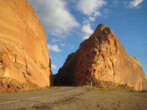
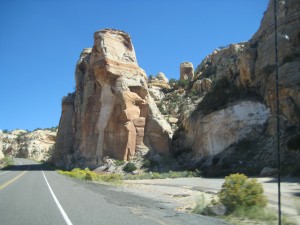
Pass in the rocks, highway to Natural Bridges

Pass in the rocks, highway to Natural Bridges

Eye Opener in Bluff, Utah — How did the Mormons get down Hole-in-the-Rock?

Arrived in the small town of Bluff as they were repaving the highway, so sat in traffic smelling tar until our time to follow the lead car.  Cottonwood RV Park is our home for three days and we have lovely views of the rock mesas surrounding us.  Elevation is around 4300 and weather is warmer than Moab.  Today, Oct. 9, we are preparing for rain.

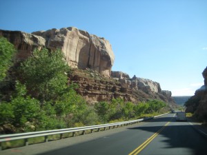
Highway Moab to Bluff

Highway Moab to Bluff

Highway scene Moab to Bluff

Highway scene Moab to Bluff

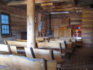
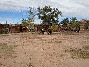
Little did we know Bluff has a replica of the original fort and pioneer cabins lived in by the first Mormon settlers that came to this area in the late 1800’s.   The Bluff Fort Historic Site fills a city block or more.  We spent several hours fascinated by the stories of the Mormon pioneers.  You hear so much about Hole-in-the-Rock Trail; at the Bluff historic site, you can read about the families that made the first expedition and built the settlement in Bluff, see an actual wagon that made the trip down Hole-in-the-Rock, watch a video about building the Trail and the first descent.  The community has built replicas of all the original cabins the settlers lived in when Bluff was settled after their treacherous journey from Escalante down Hole-in-the-Rock Trail.

Mormon schoolhouse in Bluff

Mormon schoolhouse in Bluff

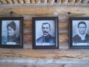
Mormon Family

Mormon Family

Fort at Bluff

Fort at Bluff

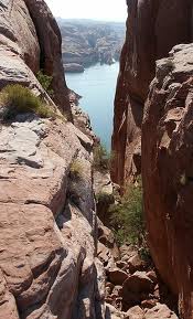
To me, Hole-in-the-Rock represents another example of the Mormon’s courage in the face of overwhelming odds, their cohesiveness and community mind set and a faith that drove them to accomplish the impossible.  They chose to devise a road down a 1200-foot sandstone cliff, a narrow, steep, rocky crevice to establish a short cut to cross the Colorado River.  Their pilgrimage from Escalante to what is now known as Bluff was to take 6 weeks (a 57-mile-long journey) and instead took six months.  In their party were two miners from Wales that played a critical role in using blasting powder to widen the crevice.  After months of working on the road, their entire party of 83 wagons, 250 Mormons and over 1000 head of livestock, made the descent in January, 1880, to the river.  Wagons were heavily roped and teams of men and oxen lowered the wagons through the upper crevice, which has slopes of almost 45 degrees.  Below that a wooden track was constructed along a slick rock sandstone slope that used posts in drilled holes to support horizontal beams.  To see a photo of Hole-in-the-Rock is to envision what an impossible task this was.  And yet, we were told, not one man, woman or child was lost, nor livestock, and in fact, two children were born on the historic journey.  And the descent was made in the middle of winter.  Tell me how this could be possible.

Hole-in-the-Rock

Hole-in-the-Rock

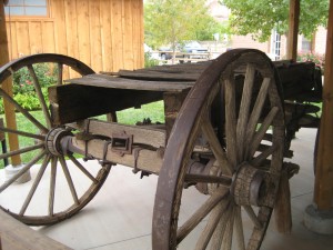
Wagon made 1800 trip down Hole-in-the-Rock

1800’s Wagon that made trip down Hole-in-the-Rock

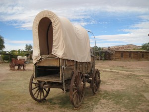
Pioneer Wagon

Pioneer Wagon

Jensen Nielson was one of the Mormons to make the expedition from Escalante to Bluff and became the leader of the Cedar City group.  Jens, as he was known, had lost the use of his feet in another expedition where he succumbed to frostbite.  The story goes that his wife, Elsie, loaded Nielson, feet frozen, into her handcart and pulled him to the next camp, saving him, though he became permanently crippled.  Jens and Elsie buried their only son on this expedition, 12-year-old Jens who succumbed to snow, cold, starvation and exhaustion, as well as did the other four men traveling with them.  On the 1880 expedition from Escalante to Bluff, It was Jens Nielson that made the decision to  go forward at the crevice known as Hole-in-the-Rock.  Jens Nielson served as ward bishop for over two decades and the first bishop of Bluff.

From a diary written by Josephine Catherine Catterly Wood about the journey from Escalante to Bluff :

All is well in health, but the life is frightened out of us.  I don’t know what this place is called, but I call it the Devils Twist, and that’s a Sunday name for it.  I cannot imagine any worse than they are here.  Aunt Mamie says, ‘My, but this is good schooling, and good for the liver.’  We are nearly jolted to pieces.  There is no use for me to try and describe it.  This is the most God-forsaken and wild country I have ever seen, read or heard about.  We hardly get started when they have to double horses on the wagons, the sand is so deep in places and in other places nothing but rocks.  Up hill and down hill, steep and slick, the poor animals.  I never saw horses pull, paw, fall down, and get up as they have today.  We do not stop for dinner, and the horses haven’t had any water, they are almost given out.

The women and children have had a good deal of walking and pushing to do so far on this trip.  The wind is blowing so bad we cannot see far ahead for the sand, and if we open our mouths, they will be filled.  The men take one wagon a little way, then unhitch and come back for another all day, so we have traveled only a few miles today.  No water again tonight, although the children are crying for it and it is very cold.  The men went hunting for water and found a little, and the children are relieved.  They fell asleep without supper and we cannot do dishes again tonight.

Traveled over rocks no human being should ever try to go over, but we kept going, until we reached the dreaded Colorado River.  I can’t describe how we ever got down, and I hope you won’t ever come to see.  Men were there with a raft.  They had two boats fastened to either side, and they would row the wagons across.  It is a wonder our wagons are not broken to pieces, for today is even worse.  We have to go down a rocky place; it is steep and slick, the men hang on the back of the wagons to keep them from rolling on the horses or from tipping back over the front.  They have to wait until one wagon is out of the way before another starts, because there is no place at the bottom to stop; just down and up; almost a ‘V’ shape.  The horses have to rest so often going up this hill, and as soon as they do, the wagons start rolling back, so we have to block the wheels by putting rocks back of them.  This is dangerous, we were afraid of being crushed.  We have been walking most of the way for two days.

The same Jody that wrote the journal entry above became the midwife for Bluff.  Between 1886 and 1908, Jody delivered 165 babies (recorded) and it is said she might have delivered twice that number.  Aunt Jody, as she was known, was called and blessed by Bishop Jens Nielson to administer to the health of the people. With very little medicine available, Jody learned from the Indians which herbs were useful and how to apply them.  The Indian people would also come to Jody for help.  Jody was an excellent midwife and often stayed with mother and baby for a week or more to help, even though she had her own family and children to care for.

Highway from Bluff to Goosenecks State Park

Highway from Bluff to Goosenecks State Park

Clouds threaten rain

Clouds threaten rain

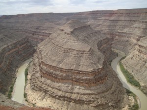
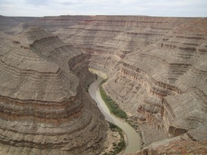
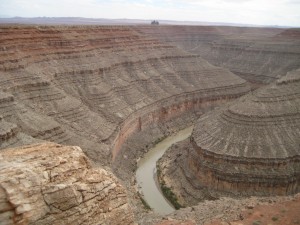
From Bluff, we took a road trip to Goosenecks State Park.  A thousand feet below the overlook, you see the San Juan River twist and turn through an entrenched river meander.  You can view the sides of the steep canyons in patterns that reflect over 300 million years of geologic activity.  Goosenecks is a nine-mile drive off the main highway but well worth seeing.  It takes your breath away, like a scene from another planet.

Sinuous goosenecks in the river

Sinuous goosenecks in the river

San Juan River at Goosenecks State Park

San Juan River at Goosenecks State Park

Steps in the canyon wall formed over millions of years

Steps in the canyon wall formed over millions of years

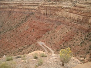
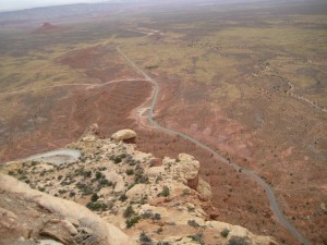
Our next visit was the Moki Dugway.  This is a dirt road that winds 1200 feet from top to bottom, 3 miles at an 11% grade.  Why did we drive the Moki?  Because it is a scary road with no shoulders and you look over the edge and get a real fright.  You feel like you are about to topple right over the edge of the road.  On the other hand, the views are incredible of Monument Valley and Valley of the Gods.  A ‘Dugway’ is a road which is dug or excavated into the land form to provide a path for transport.  The Moki Dugway was built to haul uranium and vanadium from Cedar Mesa at top to Mexican Hat.

Beginning the Moki Dugway

Beginning the Moki Dugway

Road excavated in the side of rock

Road excavated in the side of rock

Looking down on switchbacks of the Moki Dugway

Looking down on switchbacks of the Moki Dugway

Looking down to the valley below from top of Moki Dugway

Looking down to the valley below from top of Moki Dugway

Our last visit was a drive through Valley of the Gods.  What I remember most is the jolting, jarring, bouncing, down and up, up and down, jostling ride.  I got just a taste of what the Mormons had to go through on their route from Escalante to Bluff.   I gripped the strap in the pickup the entire route, a comfortable, warm, dry conveyance with music, food, water, nothing compared to the Mormons traveling in their open wagons with canvas sides in the dead of winter.  The Valley of the Gods drive is seventeen miles through BLM lands–I’m surprised the road wasn’t closed.  The sandstone formations loom from the desert floor in odd shapes and sizes and captivate the imagination.  The road crosses many washes and is not recommended driving during inclement weather.  We held our breath as rain was predicted for the afternoon which would make the road a nightmare.  The sentinels and monoliths of sandstone were sculpted over eons of time and date from 250 million years ago, deposited in huge sand dunes near the shores of an ancient sea.

A sandstone formation, Valley of the Gods

A sandstone formation, Valley of the Gods

Unique formation, Valley of the Gods

Unique formation, Valley of the Gods

Tall monolity

Tall monolith

Sandstone formation

Sandstone formation

Rainclouds over Valley of the Gods

Rainclouds over Valley of the Gods

The rains did come — last night — we were pummeled by a pinging and dinging on the trailer roof, along with strong winds, thunder and lightning.  So we took a day to hunker down, stay warm and dry, read and write.  We will stay in Bluff through Friday night, then Saturday night at Gouldings campground near Monument Valley.  Our stay at the North Rim of the Grand Canyon is still up in the air.  We are taking it a day at a time.  We hear one thing and then we hear another, about whether the parks will open.  We strain to catch the names of the parks that are said to be opening.  I wonder how history will record the 2013 shutdown of the Federal Government.  I definitely have ‘my version.’

Clouds leaving Valley of the Gods

Clouds leaving Valley of the Gods

Red Rock Café and Trading Post, Bluff

Red Rock Café and Trading Post, Bluff

Moab–Love it or Leave it

Love the bike paths that enable amateur bikers like myself to have a grand time.  We biked from the edge of Moab to Arches National Park, as serious bikers streaked past us, but we were content to go at our own pace, enjoying the sunshine, the red canyon walls, the rock formations, the beauty all around us.  It was a warm, crisp fall day and the canyons stood out sharply against the blue sky.  The Colorado River was a sluggish gray green, winding through the canyon, life-giving water but the river looks old, worn, tired.

Moab Canyon Pathway

Moab Canyon Pathway

Bill riding Moab Canyon Pathway

Bill riding Moab Canyon Pathway

Coming into Moab on bike pathway

Coming into Moab on bike pathway

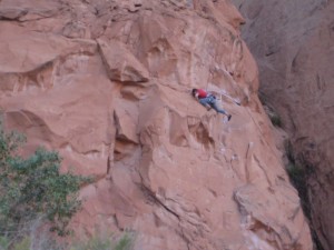
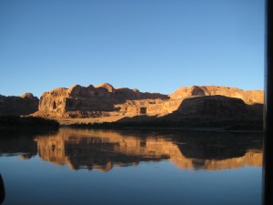
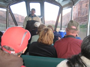
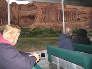
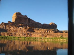
Loved Canyonlands by Night or Day where we stopped on our bike ride and signed up for a jet boat tour of the Colorado River.  We met at 5:15 pm and boarded our boat at 5:30.  It was warm and sunny.  With the first jet stream of river water splashing us as the boat sliced through the river, a chill set in.  We moved from the upper level in the back of the boat to the more protected lower level and with our jackets and scarves, were kept from shivering.  We sped 18 miles down river as the sun set.  Some of the highlights were climbers scaling the rock walls, petroglyphs, arches, the magnificence of the canyon from the river, the light on the river as the sun set.  We observed from the safety of our boat human specks high on the rim of the rock canyon when our guide asked us if we liked to see people jumping off cliffs.  Suddenly we saw a body flying through space, then a black parachute opened and the parachute floated down into the canyon and disappeared.

One of many rock climbers

One of many rock climbers

Canyonlands by Night or Day

Canyonlands by Night or Day

Colorado River from our jet boat

Colorado River from our jet boat

Our guide had an excellent schtick, referring to himself as a local and he kept the jokes rolling.  The locals don’t mountain bike, he said, but they love to hang out at the trails to see the bikers come down, then the ambulance.  That led to our guide telling us Moab had had nine rock climbing fatalities this year.  Search and Rescue is called at least three times a day to rescue mountain bikers, lots of broken bones, mainly broken legs.  On our boat, there were tourists from New Zealand, UK, Ohio, Atlanta, Canada, Georgia, Washington, Oregon, Texas, and one man from Utah.  According to the guide, only 2% of their visitors are from Utah.  Tourism is Utah’s main industry, second is movies, third is mining, predominantly potash.

Our Guide on Canyonlands Sunset jetboat cruise

Our Guide on Canyonlands Sunset jetboat cruise

Rock wall of the canyon

Rock wall of the canyon

Sunset on the Colorado River cruise

Sunset on the Colorado River cruise

Don’t like this about Moab:  traffic is horrible; and the bikers are part of the problem.  Getting through town, we constantly had to be on the lookout for a biker flying down the street or around a corner. You can’t walk down a sidewalk without encountering a biker.  Granted, there was a bike manufacturers gathering, “Outerbike” where the bikers could demo bikes, party, drink, eat and test the bikes on Moab’s world class trails.  If that added to the mayhem, it was true Sunday was calmer and less hectic, much easier to get around.  The main street through the middle of Moab is where all the traffic must drive to get through town, huge trucks included.

Downtown Moab

Downtown Moab

Our River Cruise ended with a chuck wagon dinner, a buffet of BBQ pork, beef, chicken and all the trimmin’s.  We met Sally and Glen at dinner.  A 30-year Lockheed employee, Glen moved to Washington as soon as he retired.  Sally’s business was sewing tote bags, and she could make as much as $1000 a weekend at community craft fairs.  All in all, a great evening and finale to our Moab stay.

Glen and Sally

Glen and Sally

Love about Moab:  some great coffee shops.  Red Rock Bakery and Cafe on Main has a latte to compete with Peet’s Coffee and the barrister was sweet, foaming and mixing the hot milk like it was an art form.

Red Rock Bakery and Care

Red Rock Bakery and Care

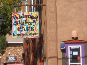
Loved all the restaurants in Moab.  Twisted Sista’s was a small plates joint, very lively and the spiciest Bloody Mary I’ve ever had — probably mixed for young bikers.

Twisted Sista's Cafe

Twisted Sista’s Cafe

Didn’t like:  a touted hike at Hunter Canyon on Kane Creek Canyon Road, said to be 2 miles one-way along a free flowing stream.  After driving 7 miles out Kane Creek Canyon Road, we found the trail by a camp and if the trail was 1/2 mile at most, I’d be exaggerating so how they came up with 2 miles beats me.  Directions said to follow the hiker-established path until the route gets blocked by brush, which it appeared to be within the first few feet.

Hunter Canyon

Hunter Canyon

Sign at trail to Hunter Canyon

Sign at trail to Hunter Canyon

Somebody's camp despite sign

Somebody’s camp despite sign

The dirt road out to Kane Creek is a beautiful drive along the Colorado River, but that Saturday it was crawling with cars, bikers, ATV’rs.  Even the ranger was seen kicking people out of the BLM campgrounds along the Colorado River which sat forlorn and empty as people scrambled to find a place along the river for outdoor adventure.

Empty BLM campsites along Colorado River

Empty BLM campsites along Colorado River

Hunter Canyon

Hunter Canyon

Really loved the biker-friendliness of Moab.  According to our tour guide, mountain biking didn’t really catch on in Moab until 1989. Now everyone in town is trying to cash in on the trend — bike shops like Poison Spider – gear shops – restaurants that serve breakfasts like Fisher Tower French Toast,  Biker Buckwheat breakfast, the Rapid Rafters Breakfast, the Mountain Biker Breakfast.  This town worships the outdoor afficiondo and has a totally different vibe from any other Utah town we had visited.   Bikers rule here!  It was unique to be in a town that gave the bicycle as much respect as the automobile.  We loved that we could ride from downtown Moab several miles to Arches National Park on a paved path that  had its own bridge across the Colorado River.  How cool is that?  Moab Canyon Pathway continues for eight miles beyond Arches to Canyonlands and the turnoff to Dead Horse State Park.  The Moab Canyon path is but one of dozens of bike trails that range from beginner to the world-famous, highly technical Slickrock Bike Trail.

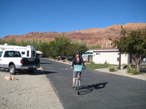
Connie biking into Portal RV Park, Moab

Connie biking into Portal RV Park, Moab

Once we found 500 West rather than ride the Main Street through town, loved that we could bike downtown from our RV Park, Portal RV Park.  We loved the Mill Creek Parkway, a two-mile path through Moab for bikers and pedestrians.  Moab has a supermarket with fresh produce; something we missed since leaving Zion and Bryce.  Even though Moab’s Farmers Market was small, we were eager to buy as much fresh produce as we could get our hands on.

Kane Creek Canyon Road

Kane Creek Canyon Road

Love it or leave it — Moab has its charms and detractions.  The Portal RV Park was a good stopover with nice views, all the amenities, several ponds and even a beach, good WiFi, and best of all it is a couple blocks off the main highway.  Despite not getting to use our reservations for Arches National Park, Moab was a good place to catch up, shop, restock groceries, do laundry and bike.

Crossing the Colorado River into Moab

Crossing the Colorado River into Moab

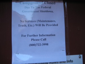
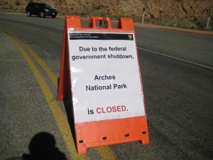
We stayed four nights in Moab — the same four nights we had reservations at Arches National Park and were looking forward to seeing Arches but like all the other visitors to the National Parks in Utah, we ran into this:

Arches National Park

Arches National Park


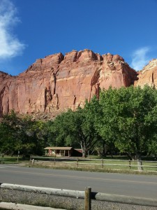
Capitol Reef National Park before Government Shutdown

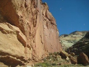
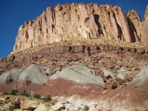
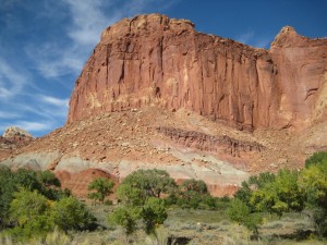
Capital Reef Cliffs

Capital Reef Cliffs

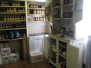
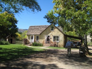
Imagine a cinnamon nut scone fresh from the oven with a cup of hot coffee/chocolate on a warm, fall day enjoyed while laying on the green grass under the shade of a tree.  We are at the Gifford Homestead in Capital Reef National Park, a replica of a pioneer home.  Its shelves are lined with bottled jams, jellies, peach, pumpkin and apple butters, salsas, cherry topping and delicious homemade foods representative of what the early residents of this valley would grow and can.  On either side, sandstone cliffs rise in patterns and colors of crimson and cream, rock canyons that swirl and wave in intricate designs.

Pantry shelves at Gifford Homestead

Pantry shelves at Gifford Homestead

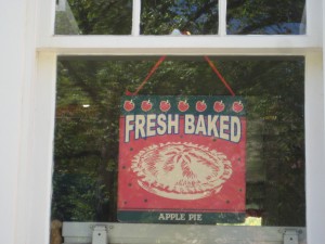
Pies, Scones, Muffins baked daily at Gifford Homestead

Pies, Scones, Muffins baked daily at Gifford Homestead

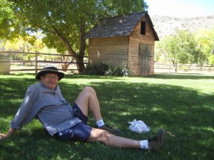
Coffee and scones on the grass

Coffee and scones on the grass

Our first morning in camp, after a hearty feast, we tackled  the winding trail just steps from our camp that climbed the rock walk to Cohab Canyon.  The rock wall was still in shadow, even though it was 10 am, so it was cool as we ascended.  The trail was steep and scattered with rocks as big as a house, huge, massive rocks perched so precariously it felt like a gentle nudge would send them careening down to the valley below.

Awesome Cliffs

Awesome Cliffs

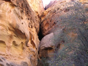
After the strenuous hike on switchbacks to the top, we viewed Fruita Campground on the valley floor; it looked like miniature trailers and cars under the trees.  We descended on the opposite side into a canyon where the sun was beginning to warm the canyon floor.  Slot canyons to either side beckoned with their narrow passages.   We felt exuberant in this insulated, pristine wilderness.  Lizards scrambling over the rocks appeared to be our only companions.  We eventually descended to Hwy. 24 which follows the  Fremont River, a small, dirty brown river (that can turn into a raging torrent) that helped to shape the canyon.

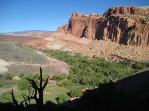
Fruita Campground from the top of Cohab Canyon

Fruita Campground from the top of Cohab Canyon

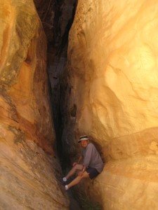
Bill in slot canyon in Cohab Canyon

Bill in slot canyon in Cohab Canyon

Patterns in rock

Patterns in rock

Walking along Hwy. 24, we came to the Fruita Schoolhouse, a small, one-room school that housed as many as 26 students from 1st – 8th grade.  The children only went to school during the winter months as they were needed for planting and harvesting during the rest of the year.

Fruita Schoolhouse

Fruita Schoolhouse

Swedish tourists in RV Caravan visit Fruita Schoolhouse

Swiss tourists in RV Caravan visit Fruita Schoolhouse

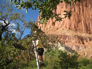
Further up Hwy. 24, we stopped at Jackson Orchard, where visitors were encouraged to pick ripe apples, weigh them, leave $1 per lb. in the steel container and enjoy what they could use.  After our morning hike, nothing tasted quite as good as a crunchy, fresh-picked apple in the dappled shade of the orchard.  Being the only pickers in the orchard was also a treat.  We dragged the ladder from tree to tree and pulled the red jewels off the tree, sweet apple smells filling the air.  We ended our hike with scones and coffee at the Gifford Homestead.

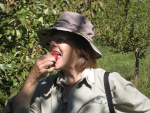
Crunch!  Tasting an apple right from the tree

Crunch! Tasting an apple right from the tree

Bill picks apples at Jackson Orchard

Bill picks apples at Jackson Orchard

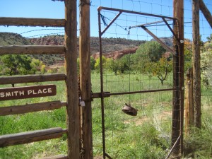
Ingenious gate to orchards uses pulley and stone

Ingenious gate to orchards uses pulley and stone

In the evening, I scrubbed and sliced some of the apples and put them on the stove to stew with water, sugar and cinnamon.  I can’t quite describe why the stewed apples tasted like heaven.  Being able to pick apples right off the tree and cook the fruit the same day seemed to connect me with the earth and the cycle of life.  It also helped to know the pioneers lived this way.  It was the best darn treat of our trip so far.  We missed terribly access to good fresh fruits and vegetables on this trek across Utah, perhaps another reason why the apples were so appreciated.  We had managed to purchase tomatoes and cucumbers at the spare (one table) Farmers Market in Escalante because we got there early and were fast.

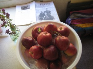
Fresh picked apples

Fresh picked apples

The orchards in Fruita were planted by the Mormon settlers in the late 1800’s — at the most ten families.  Often these Mormon “families” had 12, maybe thirteen, even as many as fifteen children so the community was larger than it might sound.    As everywhere else in Utah, struggling to make a life in Fructa was hard.  “This was the country the Mormons settled…  Its distances were terrifying, it’s cloudbursts catastrophic, it’s beauty flamboyant and bizarre and allied with death.  Its droughts and its heat were withering.  Nobody else wanted it, nobody but a determined and God-supported people could live in it.” Wallace Stegner.  Mormon Country

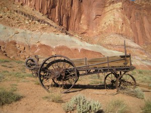
Old Farm implement, Capitol Reef NP

Old Farm implement, Capitol Reef NP

To the Mormon settlers, home was not just a shelter made of lumber, but a construction held together by faith.  The land could be unkind to those attempting life here.  Searing heat, bone-chilling cold, dusty drought, and devastating floods caused early pioneers to move hard-won settlements.  Other towns sprang up nearby and failed, but the Mormons held on abiding by faith.   Diseases like smallpox and diphtheria took their toll.  The girls married as early as fifteen and oftentimes were mothers before they were sixteen and might have born a child every year for the next 12 to 13 years.   They were completely isolated in the canyon so they were self reliant and community oriented, taking care of one another, marrying each other, praying, dancing, singing and socializing together.  If someone fell ill, they often used home remedies in caring for one another.  A midwife helped the mothers give birth; rarely was a doctor in attendance.

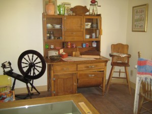
Gifford Homestead Parlor

Gifford Homestead Parlor

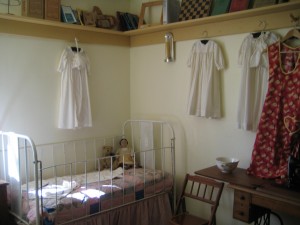
Child's room, Gifford Homestead

Child’s room, Gifford Homestead

The orchards have been preserved for visitors when Fruita became part of the National Park system.  Only a few of the original settler buildings remain.  The Gifford Homestead was once the actual home of several pioneer families.  An old barn remains and a blacksmith shop but none of the Mormon settlers live in Fruita anymore.  Deer roam through the orchards and campgrounds.  It is a picturesque and sweet scene in late September, in the upper 70s during daytime and upper 50s at night.  The trails are numerous taking you back in the canyons and the scenic drives are awesome.  If I had the strength, biking would be my preference to see the canyon and we did pass a few intrepid bikers.  There is no store, firewood, Wifi or cell phone coverage but there are lots of very large trailer rigs, ours included.  The campground has no hookups.  There is a dump station.

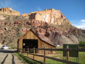
Remnant of settlers; barn in Fruita

Remnant of settlers; barn in Fruita

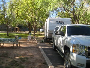
Fruita Campground, Capitol Reef National Park

Fruita Campground, Capitol Reef National Park

With no electricity or Wifi, we sat under the stars in the evening and read aloud chapters of “Desert Solitaire” by Edward Abbey.  It made the book all the more meaningful to feel we were a part of this desert and canyon and universe in the stillness of a dark night at Capitol Reef.  It is an odd time to be so removed as news coverage is so limited.  However, making purchases at the Gifford House today, I was caught up in a conversation about whether the Park would be open the following day.  The big question on everyones mind: Will the United States government shut down at midnight.
Gifford Homestead

Gifford Homestead

October 1.  We awoke to find the Rangers had been busy this morning posting signs at the trailheads, the visitor center and at the entrance to the park:  CLOSED Due to the Shutdown of the Federal Government.  We packed the trailer and were sad to say goodbye to this beautiful park with its majestic domes, arches and unusual canyons striking in their beauty, the orchards, and the ghosts of pioneer Mormons.

Canyons on Scenic Drive in Capitol Reef

Canyons on Scenic Drive in Capitol Reef

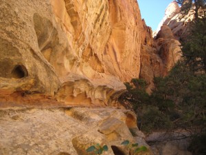
I read the rocks in Capital Reef record nearly 275 million years of history, rivers and swamps, Sahara-like deserts, and shallow oceans.  Within the last 20 million years, an uplift of the Colorado Plateau occurred and this, along with erosion, water and wind, rock falls and rock creep shape the landscape today.  It is truly unbelievable.  I certainly felt some anxiety about rock fall, as massive boulders are perched everywhere as you drive the paved Scenic Drive and they look like they were literally stopped in their tracks and might continue to fall at any moment.  Side roads to Grand Wash and Capitol Gorge take you even further along the reef where water has cut completely through the towering walls of stone.  It feels like you are being swallowed up by the earth as you descend.  As we travel from west to east across Utah, each National and State Park becomes my new favorite. Today Capitol Reef definitely tops my list.

Slot canyons

Slot canyons

Sandstone patterns

Sandstone patterns

If Capitol Reef was at one time rivers and swamps, then transformed to a desert, then covered with an ocean,  and today is the rocks and canyons we see today, doesn’t that mean climate change is a given?

Travelers in the orchards

Travelers in the orchards

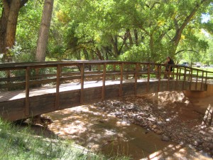
Crossing the Fremont River

Crossing the Fremont River

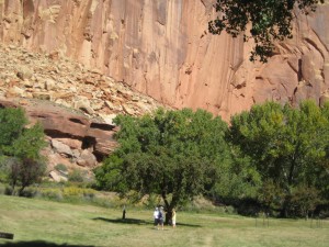
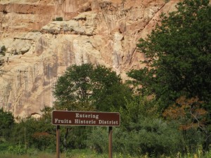
Fruita Historic District

Fruita Historic District

Orchards against canyons

Orchards against canyons

A Kaleidoscope of sights: Hwy. 12 from Red Canyon to Torrey, Utah

Circle D Eatery, Escalante

Circle D Eatery, Escalante

Highway 12 from Red Canyon to Torrey is designated a Scenic Highway.  We headed to Escalante where we planned to spend one night and attend the Plein Air Art Festival.  The night we arrived it was quite cold, so we wrapped up and went to The Circle D Eatery, next door to Canyons of Escalante RV Park.  if you want great food at a fraction of the cost of a San Francisco restaurant, the Circle D is the place.  Don’t let the name fool you.  They have the best homemade Creme Brûlée I’ve ever had.  Bills steak was better than “Mortons.” Vegetables were done al dente perfectly.  Breakfast and lunch were equally superb.  The Circle D Eatery was a real find.

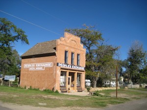
People's Exchange Historic Building, Escalante

People’s Exchange Historic Building, Escalante

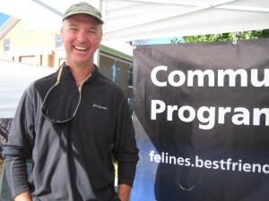
The Escalante Canyons Art Festival was running two days, Friday and Saturday, but the artists had been at work creating for the week prior.  Arts and Crafts, great music, local quilts, food and Plein Air art made this one of our favorite stops along Hwy. 12.  We loved chatting with Matt How, who we met as we walked in.  Matt was manning a booth for a friend.  Matt was building a straw bale house in the Escalante area and he shared insider information about how a straw bale house is built.  We enjoyed the architecture of the garage, which had already been built and Matt’s friendly, gregarious nature.  Matt is a graphic designer by trade and works for the government in Portland, Oregon, designing brochures and doing the art for the National Parks and BLM.  Plein Air art is painting on location or in the open air and is usually done during the course of the festival.  All of the art reflected the artist’s  interpretation of the scenery, canyons, mountains, and landscape.

Matt How tells us how to build a straw bale house

Matt How tells us how to build a straw bale house

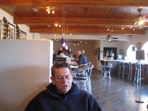
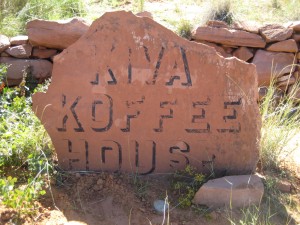
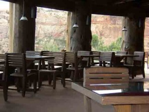
Our next stop was the Kiva Koffeehouse on the outskirts of Escalante.  Kiva Koffeehouse was created by artist, mentor, contractor, inventor and engineer, Bradshaw Bowman.  It took 2 years to collect the 13 Ponderosa Pine perimeter logs from the high forests of the West. Some of these logs have nearly 300 rings, existing even before our country was born. The smaller interior logs and Vigas (rafters) are Spruce. The latillas are from smaller Lodge Pole Pine. The sandstone walls were quarried from an on-site quarry.  Not only is the Kiva Coffeehouse a great architectural interest, the views are unequaled, the coffee, homemade soups and sandwiches a much-needed respite for the traveler.

Kiva Koffee House

Kiva Koffee House

Kiva Koffeehouse Interior

Kiva Koffeehouse Interior

Driving Hwy. 12 from Escalante to Boulder is a kaleidoscope of sights and views, canyons, slick rock, striated cream-and-red sandstone formations, plateaus, mountains, flowing water, and native vegetation. You simply cannot take it all in during one day; yet, that is what we did and I think it would be compared to trying to see the Louvre in Paris in one hour.  We actually drove right through the “Hogback” which is described as “a thin, razorback ridge of slick rock, spilling steeply off on each side,” so much enjoying the vistas we didn’t even recognize the danger.  Perhaps we are too accustomed to the twisting road to Sea Ranch with drop offs to the ocean that the Hogback didn’t seem so bad.

Connie takes in the scenery Hwy. 12

Connie takes in the scenery Hwy. 12

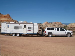
Our rig on the way to Torrey

Our rig on the way to Torrey

We did enjoy the Anasazi State Park Museum outside Boulder.  Anasazi refers to village-dwelling farmers who existed in this region from A.D.1 to 1300 and the site has been partially excavated and reconstructed. No one knows why the village was abandoned around A.D. 1175.  I am just grateful for my modern house and technology; I shudder to think of living in the pit structures and small rooms the Anasazi lived in, hunting for food, farming and gathering seeds, nuts and berries.  Average life expectancy was 33-35 years we read.  Tooth decay, arthritis and famine were a way of life.  Almost makes me grateful for the current fight over healthcare.

Aspens on Hwy. 12 above Boulder

Aspens on Hwy. 12 above Boulder

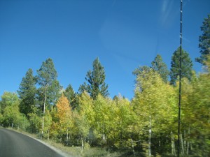
Once we left Boulder, scenic Hwy. 12 starts climbing.  We were sure each time we topped a hill, we were at the high point and would start the descent.  But no, we kept rounding a curve to find another hill.  The Chevy Silverado is a powerhouse pickup and darned if it didn’t pull our 23′ trailer up and over that mountain with not even a hiccup.  The elevation at top is just over 9000 feet.  The landscape here turns to most noticeable Aspen, but also pine, spruce and fir.  However, it is the Aspen that we remember — more Aspen than we can ever recall seeing, in beautiful fall color of golds and yellow-green, miles and miles of quaking Aspen.

Thousand Lakes RV Park, Torrey

Thousand Lakes RV Park, Torrey

View from trailer at Thousand Lakes RV Park, Torrey

View from trailer at Thousand Lakes RV Park, Torrey

When you descend the mountain, you arrive in the pleasant town of Torrey.  Our home for the night was an RV Park called Thousand Lakes on the outskirts of town.  Amazing views here and all the amenities.  The only grocery was a small market, Chuck Wagon Grocery, not much selection for fruits or vegetables.  We found “Slackers” the next day — great burgers and Wifi.  Right after we got our orders, I looked up to see a line of about 25 people.  Say what?  Then a lady who overheard my shocked expression, said “don’t worry; we’re not taking over your town.” Evidently a tour bus pulled in to this roadside diner and expected them to churn out enough burgers to feed the county.  Well, all good business for the diner, but I’m grateful we already had our food.
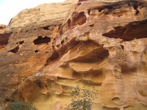
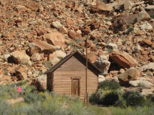
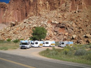
On the road Escalante to Torrey

On the road Escalante to Torrey

Next stop:  Capitol Reef National Park where we hoped to find a spot for the trailer for two nights.  Little did we suspect what was coming down the pike, a dysfunctional government that would upend our vacation plans like a royal pain in the …

Across the Hogback, Highway 12

Across the Hogback, Highway 12

Pioneer? Or not?

You will notice all my photos are together in a Gallery and my blog follows.  This was an experiment clicking buttons.  I personally like having the photos intermixed with the narrative.  What do you think?  For now, while we are traveling, using the Gallery is much easier.  Enjoy this post on our travel to Kodachrome Basin State Park, Bryce Canyon National Park, Tropic, Cannonville, Panguitch and Red Canyon, Utah.

In Steve Jobs biography, the author quotes employees of Jobs saying more than once Jobs made them believe they could do the impossible and somehow they did it because they didn’t know how impossible it was.  Here in Utah, it appears the impossible was done by those intrepid Mormon pioneers.  In story after story, I read how these Mormon pioneers accomplished deeds an ordinary man would almost be incapable of because of their faith, their perseverance and ingenuity.  Now I contemplate what that faith enabled these men and women to accomplish.  Perhaps it gave them a tenacity to keep going where most men would give up because the Mormons believed God was leading them.  Maybe these pioneers received powers of the Spirit that enabled them to do heroic deeds.  Did these pioneers receive miracles exactly at the moment they needed one?  I only know that through their determined tenacity and grueling, backbreaking work, Utah is what it is today.

I tried practicing a little of the Mormon pioneer spirit today biking Red Canyon.  If you believe the Dixie NF Visitor Guide, you would know this 9-mile bicycle trail is an easy ride on a paved trail along Highway 12. If you believe this pioneer wanna-be, you would know the trail is a grueling uphill grade from its beginning at the Thunder Mountain Trailhead to its end at the Coyote Hollow turnoff.  It might help to understand that my biking skills are modest, pleasure riding skills best practiced on flat ground.  I felt when I began that if I managed a couple miles, I would be doing fine. The wind was at our back on this bright, sunny fall day.  As I hit about mile 5 of the uphill grade, these were some of the messages cursing through my brain:  you can do this; if someone were by your side encouraging you, you would keep going; God has given you physical health and ability so use it; you cannot quit because the future depends on you; well, you get the gist.  Basically I was pretending to be a Mormon pioneer and understand what kept driving them to do things almost humanly impossible [it truly felt like I couldn’t possibly do one more hill; my legs were like rubber].  I am thrilled to say we did make it to the Coyote Hollow where the trail flattened out to a plateau. On the ride back, with the wind at our face, the bikes flew down the grade with almost no effort.  I screeched to a halt often because of the incredible views of the red canyons, spires, tunnels, arches, and vistas.  The landscape is so rich and vast and gives you a feeling of expansiveness and grandeur and awe.

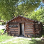
Mossy Cave trail is an easy .8 mile walk on the perimeter of Bryce National Park.  Yet on this trail, you also can see the waterfall and what is known as the “Tropic Ditch.”  Early Mormon pioneers excavated a 10-mile ditch using hand tools to channel water from the Sevier River to the Paria River.  This allowed settlers to successfully farm, grow orchards and raise livestock in an area known as the town of Tropic.  A young man that became a Mormon at age 18, Ebenezer Bryce, was called to help establish a settlement in the area.  Ebenezer and his wife had 12 children that were all raised to adulthood, an almost impossible task in 1875.  In Tropic, you can find the homestead cabin built by Ebenezer, a rather crude, one-room log shelter.  I poked my head inside the dark, dusty cabin and had nothing but praise for any woman that could call this log shelter home, and if she raised a family in this shelter, well, she was nigh near a saint in my eyes.  My experience with wind and sand at our campsite nearby led me to think pioneer women must have had a continual fight to keep their homes clean battling the elements.  Which is nothing to speak of compared to having to haul water in a barrel for the needs of a family.  You can imagine why there was such celebration when the Tropic Ditch delivered the first stream of precious water to the pioneers that had settled in Tropic.  When we returned to our camp after the days outing, I tried to imagine being one of those Mormon women as I viewed our tarps tossed and blown by the wind, sand everywhere, grit on the table, bed, floor, everything I touched seemed to have a layer of grit and sand.  Our comfortable trailer with glass windows and tightly sealed seams could hardly compare to log cabins and abodes where cracks and crevices must have been commonplace.

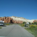
At Kodachrome Basin State Park, we are surrounded by towering sandstone chimnies and spires in this redrock semi-desert Park.  My brother tipped us off about Kodachrome, where we booked five nights.  We are in a basin surrounded by the Colorado Plateau with distinctive features called Sedimentary Pipes, columns of rock that rise from the basin floor.  Here we have full hookups for our trailer.  In this part of Utah, this is an unexpected benefit but so very useful as temperatures dip in the 30s at night and a flip of a switch turns the heater on to keep us warm and cozy.  Meals are fast and easy with a microwave and pre-prepared food.  Electricity enables us to have music and light to read by.  Yet we are in an unexploited basin where night skies are brilliant with stars and quiet echoes off the Plateau and giant rock sentinels.

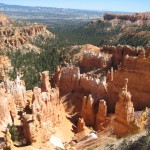
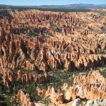
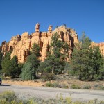
From Kodachrome, we take side trips.  Bryce Canyon National Park is a 20-minute drive.  From the Lodge at Bryce Canyon, we hike to Sunset Point and Sunrise Point, then follow the Rim Trail to Bryce Lookout.  From the rim trail, we see endless vistas of hoodoos, fins, mazes, and spires etched into the pink limestone of the Paunsaugunt Plateau.   At Bryce lookout, we catch the shuttle back to the Lodge for lunch and Wifi.

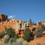
Panguitch is another side trip, a small town that is an historic Mormon pioneer settlement.   We stopped at an art gallery whose owner, Veda Hale, painted all the art in the gallery and authored a book titled “Swell Suffering,” a biography of Maurine Whipple.  We learned from Veda that Maurine Whipple was the author of a book titled “Giant Joshua” that Veda explained drew parallels with Gone With the Wind, from a Mormon perspective.  Veda was so interesting to talk with.  Two of Veda’s paintings were dear to me, not only as art but also as a reflection of a belief system, a world view I found very endearing.  From Panguitch we drove back to Red Canyon on Highway 12.  Red Canyon is a series of spires and hoodoos eroded out of red limestone and sandstone.  A paved bike trail runs parallel to Highway 12 for nine miles.  Here we stopped for a bicycle ride, the five-mile one-way ride mentioned earlier.

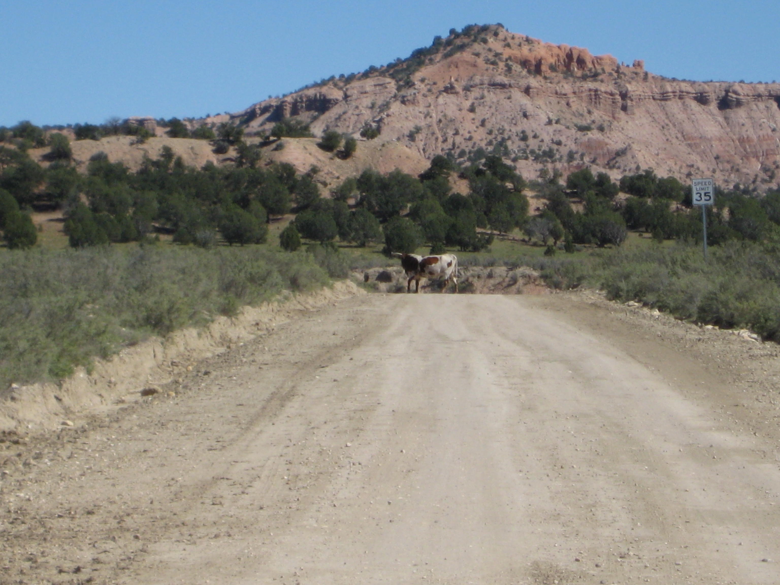
Biking around Kodachrome Basin proved adventurous.  Right outside the Kodachrome entrance is a dirt road to Cottonwood Canyon and Grosvenor Arch.  There was a sign “Road Closed” which we ignored.   We rode for miles seeing nobody but vast stretches of desert-type sand landscape with sparse vegetation.  We eventually realized we were riding through someones ranch as cows eyed us from either side of the dirt road, and a cow with horns sauntered across the road in front of us.  Eventually we came to a crossing guard and could see far in the distance farm buildings against the base of the plateau.  We wondered if a Mormon family lived way out here in isolation, but decided to turn around and bike back to camp.  The road was marked with small signs with numbers like “400” which meant nothing to us.  We spoke with an old timer at the camp store who said he had to pull cars our of the mud where they sink after rainstorms; the old timer said the mud is like quicksand and the cars become caught like animas in a trap.  The road was closed because of recent rainstorms.

Kodachrome has no Wifi or cell phone coverage.  One evening we drove to Bryce Canyon NP to attend an astronomy program on Virgo, followed by stargazing through the National Park telescopes.  We saw the Andromeda Galaxy, the Virgo Constellation among others.  Bryce is rated as a phenomenal place for stargazing; we swear stargazing from the Hot Tub at Bella Luna in Sea Ranch is certainly every bit as phenomenal.  In fact, we often see the Milky Way at Sea Ranch every bit as powerful as we did at Bryce.

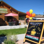
In Tropic, we stopped at the Bryce Canyon Coffee and Tea Shop with WiFi.  After the breakfast crowds left, we had the shop to ourselves for hours.  Across the street is the Tropic Heritage Center and library.  They have a shelf of books on Mormon history in the Bryce Valley area of Utah which I found fascinating.  We got kicked out when a man came to close up after 5 p.m.    At Bryce Canyon Lodge, there are numerous electrical outlets to plug in if you are addicted to your technology and need powerful WiFi.  The Lodge has a rustic restaurant that serves breakfast, lunch and dinner.  Clarks Restaurant in Tropic serves good, homespun meals.  Rubys Inn in the town of Bryce Canyon is the most extensive gift shop, restaurant, grocery store, gas station, Internet Service and if it can be sold, you can find it at Rubys, all-encompassing shopping we’ve found in Utah.

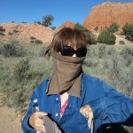
The Panorama Trail in Kodachrome SP takes you to several caves, up close to the spires and rocks and to a canyon and eventually up a hill to Panorama Point.  You can hike for 3 miles or take all the side trails for a 6-mile hike.  We ran into a couple from Boston that were quite the adventurers.  He was a math teacher, she a nurse.  They were tent camping.  When asked if we saw the Star Show, we were perplexed, asking if the Park put on a show.  No, they said, we laid on the rocks for hours and observed the stars–beyond beautiful.  With the recent winds and drop in temperatures, I admired their grit.  Even with the heater running in the trailer, the cold chilled me to the bone.  I had a handkerchief wrapped around my head that day to contain the dust and keep a sinus headache at bay, to no avail.  Kodachrome Basin State Park is a gem tucked back in the hills and has lots of opportunities to enjoy the outdoors hiking, biking, ATVing, and exploring.  I was sorry to leave but we packed up the next morning, heading to Escalante and all the new adventures waiting for us.

Zion National Park, Shuttle Rides, Canyons, People

Entrance to Zion National Park

Just because it’s September and the kids have returned to school doesn’t mean there will be no crowds at Zion.  Several months in advance we tried to make reservations to camp at Zion and were only able to get two days simultaneously; so we split our time between two campsites.  We were up early the morning we switched to our second campsite and ready to move out by 9 a.m.  But the second campsite was not vacated and the group staying there used every minute of their time before check out until 11 a.m.  We had time to bike to town and have breakfast at Deep Creek Coffee Company.  Deep Creek has a neat open air deck upstairs where you can enjoy views of the canyons; very good, strong coffee and nice breakfast menu; silly me, I just ordered oatmeal but it was flavorful and substantial (not just a mix with hot water stirred in).

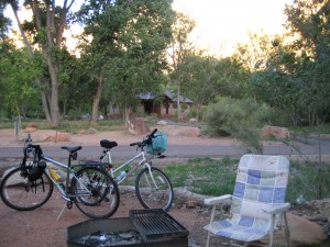
Our bikes ready to roll

Our bikes ready to roll

Back at camp, we still had an hour to kill so Bill drove the trailer to the Dump Station to empty the gray and black water and fill the trailer water tanks.  He pulled in behind a huge fifth wheel rig.  The driver got out, inspected the dump station, the hoses, his rig, then donned plastic gloves.  Thirty minutes later, the man meticulously finished his job, surveyed everything in front of him with satisfaction and drove off.  It was a lesson in patience for certain for Bill, but mostly agitation that anyone could be so thoughtless when other people were in line as to take his own sweet time and then stand back admiring his work.


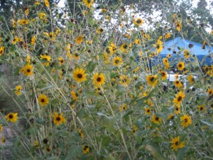
We liked all the wildflowers at the campsites in Zion.  Our 2nd site had a group of golden daisy like flowers so pretty to enjoy while eating.  The shade from overhead trees also helped as temperatures were in the high 90’s in daytime.  We liked having space between us and other campers.  We happened to land right in the middle of a group of Airstream Trailers that were caravanning together.  You could look down our row and see one after the other shiny, aluminum,  Airstream trailers as big as houses.  The RV sites have electrical hookups (at Watchman campground).  I love having a microwave while camping.  It makes me feel like I am really roughing it.  The canyon walls were visible from our trailer in both sites and the moon visible in all it’s brilliance giving a ghostly glow to the canyon and all it’s inhabitants.  We could walk to the camp programs by the light of the moon.  We always learned something at their programs.  For instance, did you know that Zion NP has the most visitors of all the National Parks, 3 million a year?  Neither did I?  And as it turns out, neither does National Geographic which lists Zion about #8 on its list.  Do you know what a crepuscular is?  It is an animal that is seen at dawn and at dusk.

Flowers at Campsite

Flowers at Campsite

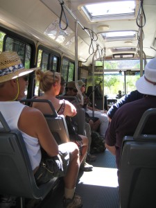
To reduce traffic congestation in the park, a shuttle system is the mode of transportation for all visitors.  The shuttles run continually from very early (6 am in summer) until quite late (10:15 pm in summer).  There is no charge to ride the shuttle.  There are ten stops beginning at the town of Springdale and ending at the north end of the canyon at Temple of Sinawava.  At any shuttle stop in the Canyon, you will find trails, restrooms, and drinking water.  A few of the trails are paved for accessibility.  The shuttle is an efficient transport system to allow many people to see the park.  I found, on the other hand, that it detracted from the wilderness experience in several ways.  Because so many people visit, hiking some of the trails is like being on a popular ride.  Being packed like sardines in a crowded shuttle bus hoping for a cool breeze through the small window opening felt too much like being in the city riding a bus.  With planning, I think you could avoid the crowds, but it beats me when or how.

Riding the Shuttle

Riding the Shuttle

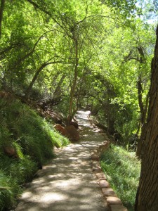
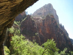
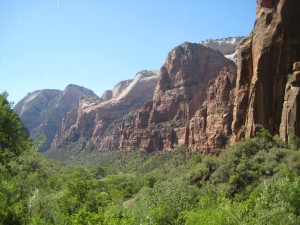
We happened to visit Zion in the midst of major construction; the Riverside Walk, Temple of Sinawava, and the Narrows were not accessible unless you walked from the last shuttle stop at Big Bend.  Buses were slower than usual because of waiting for construction crews to give the OK to pass.  And our last morning, the construction crews fired up their engines right outside our camp at 8 am, making it feel anything but peaceful.  They also closed the Dump Station that morning so we sloshed all the way to Cannonville (don’t ask!). Yet there is so much to see and do, there are always options if a door closes on you.  We chose the Weeping Rock Trail on our first shuttle ride.  You can stand in a grotto under the dripping springs  and view the canyon for miles.  The cool water is gentle on you and cools a hot body from a crowded shuttle.

Trail to Weeping Rock

Trail to Weeping Rock

Under the Weeping Rock

Under the Weeping Rock

Canyon View from Weeping Rock

Canyon View from Weeping Rock

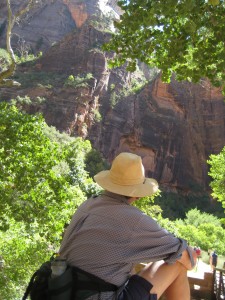
Bill on the trail

Bill on the trail

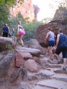
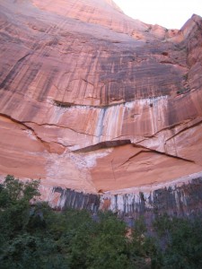
Our next stop was The Grotto where we joined hundreds of other hikers on the Kayenta Trail to the Emerald Pools.  Bill thought as long as we were hiking and in Zion, we were going all the way, to the Middle Emerald Pool  and up to the top to the Upper Emerald Pool. We thought for all the effort, we were in for a dazzling sight.  What we found was a large pool with about fifty people sitting on rocks staring as more people emerged from the hike up.  Well, that was interesting, we thought.  Back down the trail and a turn to the Lower Emerald Pool, which turned out to be my favorite of the three pools.  There was not only a beautiful Emerald pool, but water dripped from above the trail offering a refreshing shower, and the rock walls were striking.  We took the paved walk back toward Zion Lodge and caught the third shuttle back to camp (the first two were standing room only).

Bill in the canyon

Bill in the canyon

Trail at Lower Emerald Falls

Trail at Lower Emerald Falls

View of Lower Emerald Pool

View of Lower Emerald Pool

On the trail to Upper Emerald Pool

On the trail to Upper Emerald Pool

Typical group of hikers on Emerald Pool Trail

Typical group of hikers on Emerald Pool Trail

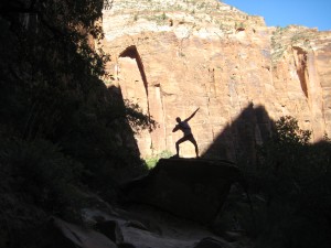
Shadow Man striking a pose on rock

Shadow Man striking a pose on rock

Looking up the canyon from Emerald Pool Trail

Looking up the canyon from Emerald Pool Trail

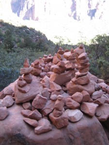
Cairns mark the trail to Emerald Pool

Cairns mark the trail to Emerald Pool

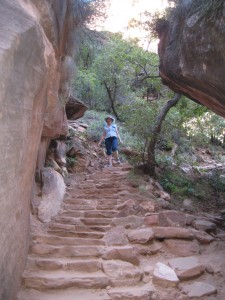
Up the Rock steps to the Upper Emerald Pool

Up the Rock steps to the Upper Emerald Pool

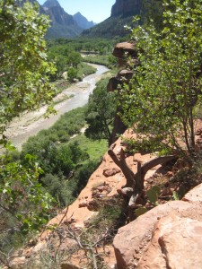
Looking down on Virgin River from Emerald Pools Trail

Looking down on Virgin River from Emerald Pools Trail

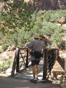
Bridge to Kayenta Trail

Bridge to Kayenta Trail

One day of riding the shuttle was enough for us, so we chose the Pa’rus Trail for a bike ride the next morning.  Although only 3.5 miles, this is an easy trail for seeing the canyon floor and enjoying the Virgin River which the paved trail crosses four or five times. Riding in the morning sun was delightful. Why did they decide to close the  Zion Human History Museum September 19?  Who knows, but we will have to visit the Museum on our next trip.  The Pa’rus Trail goes right by the Museum.

Zion from the Shuttle

Zion from the Shuttle

Back at camp, we came across a trailhead called Watchman Trail 2.7 miles round trip.  Let’s do it.  What a treat this trail was.  It ascended for it’s entire length, working it’s way up the red sand and rock canyon, crossing water you could smell and feel, but rarely see.  We knew there must be a real treat for us at the top and there was–views for miles of lower Zion Canyon and even the town of Springdale.  But the most memorable treat for us was meeting a young couple from Israel with their baby in a backpack.  We talked and joked and compared notes on trails and highways and the young man showed me how to update the IOS on my IPhone, of all things, on the top of this cliff, hands on.  The couple also shared the “inside scoop” that someone like me doesn’t have a clue about–to install the IOS at night because it takes a long time and uses memory, so, they told me, make sure you are plugged in to a power source. The walk back was a piece of cake, all down hill.  The best part was the trail was not crowded, I guess because it is not a shuttle stop but begins across from the Visitor Center.

WatchmanTrail2

BillConnieWatchmanTrail

After our hike, we rode our bikes to Springdale.  It is surprising to find a town with lots of restaurants, coffee shops, gift shops, Wifi within a mile from the entrance of Zion.  When the sun began to set, we decided it was time to head back to camp.  We flew on the downhill slope, holding on for dear life, with a cool breeze energizing, and enjoying the sun setting on the canyon walls as another day came to a close.  We really enjoyed our visit to Zion.  In four days, we only saw a glimpse of all there is, but we saw enough people to get our fill.  We will research a less-populated time to visit.  The icing on the cake was our last campfire program.  Night had fallen, stars were just beginning to shine, and the beautiful night was shattered by the sounds of music.  We learned the Zion Theater at the north end of Springdale was having a live outdoor concert.  The peace and solitude of the Canyon was nonexistent.  It was loud, it was Rock, and it was not conducive to the wilderness of Zion National Park.  The Park Ranger had to strain to be heard above the noise.  We walked back to our campsite in the moonlight thinking what a strange world it is, beautiful, awesome, and contradictory.

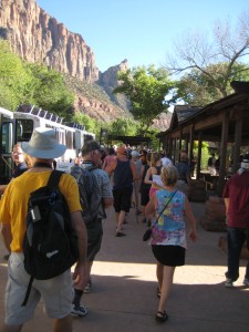
Crowds!  Visitors disembarking from Shuttle

Crowds! Visitors disembarking from Shuttle